Happy Second Winter!

Hello once again, Oswegonians.

The middle of the semester has been a tough one, both mentally and weather-wise! The weather has been flip-floppy, going from a mild February pattern featuring several 60º+ days to a snowy and cold March in a matter of days. Welcome back to winter, round 2!!

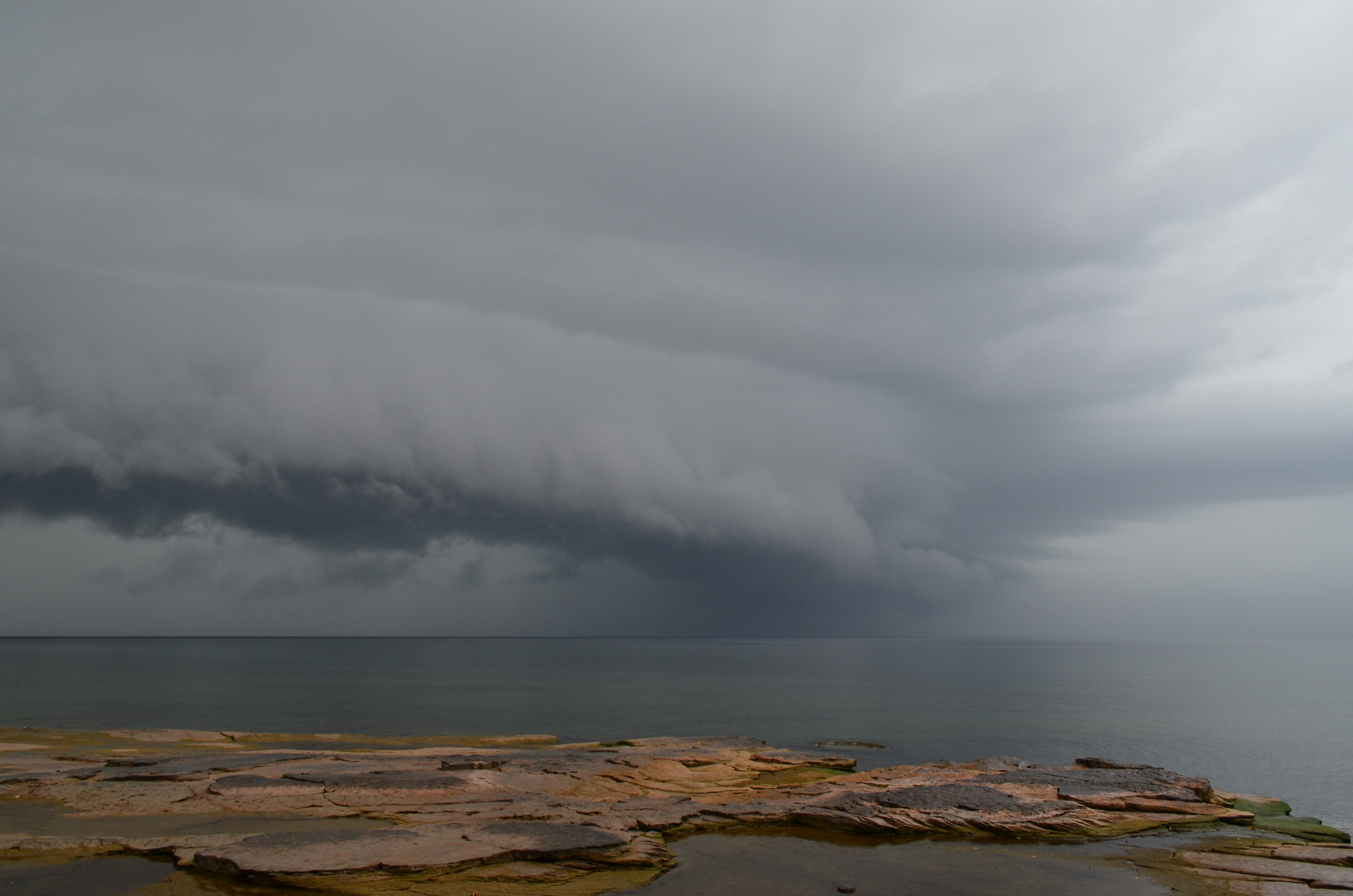
The weather…well, that went on spring break too, apparently. Mid last week, a large nor’easter tracked up the coast, delivering snow that was measured in feet to nearly all of New York State. Oswego measured approximately 10 inches from this event, however the wind whipped up some 3-6 foot drifts across campus. My area (Ithaca) received between 15-27 inches of snow, while some locales in the western Catskills and Mohawk Valley picked up well over 30″. Talk about snowed in!

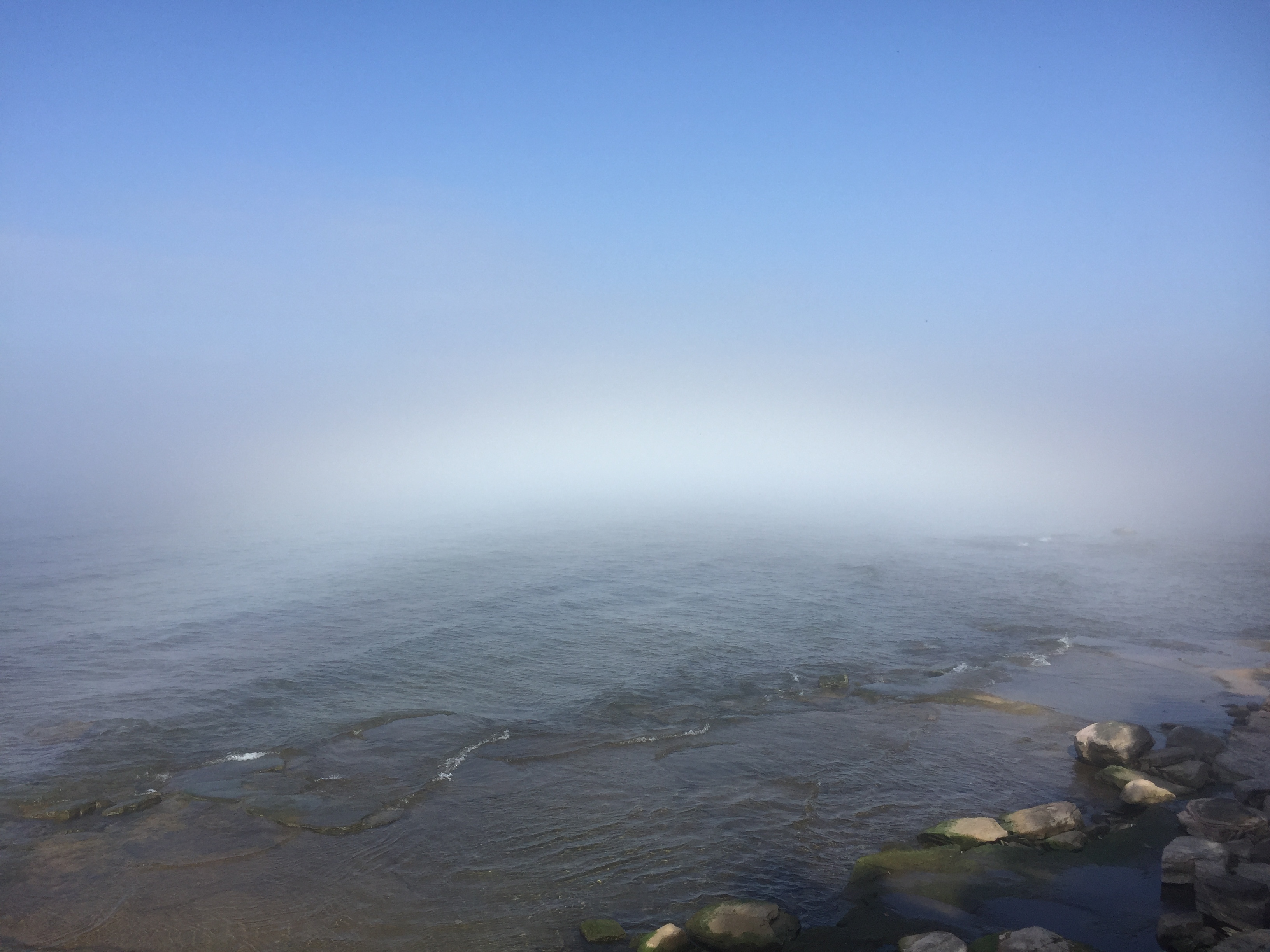
Today, Mother Nature has delivered a fleeting shot of Arctic air to Oswego, with the high barely climbing above 20º. Classic Spring weather moves in by Friday, with lots of rain showers in the forecast right into next week. Bye bye, snow and cold. Hopefully we can add some warm, dry days to the mix in the near future.

I’ll hopefully have another post soon with more content. Until then, have a great week Oswego!

DSC_1832

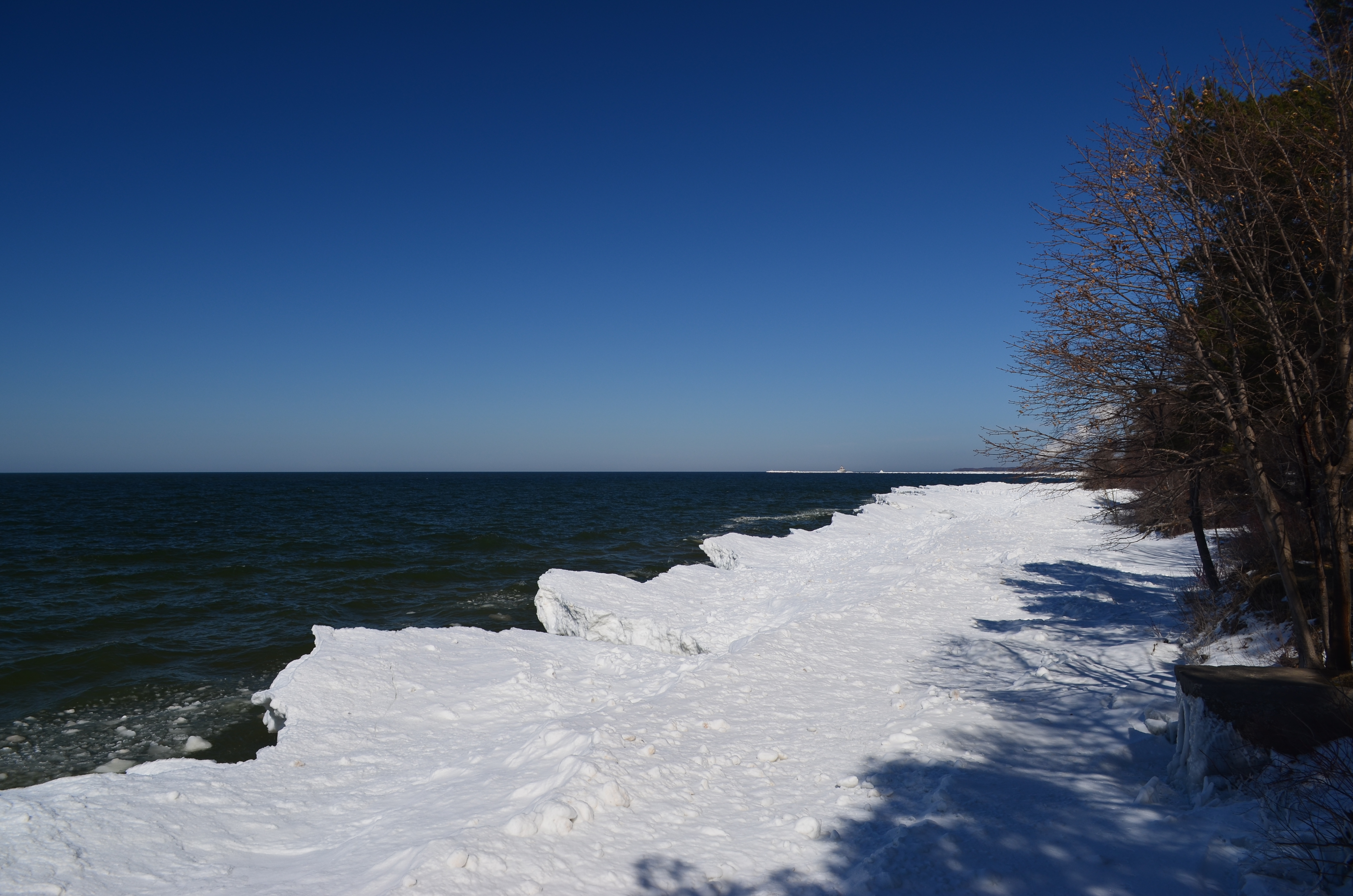
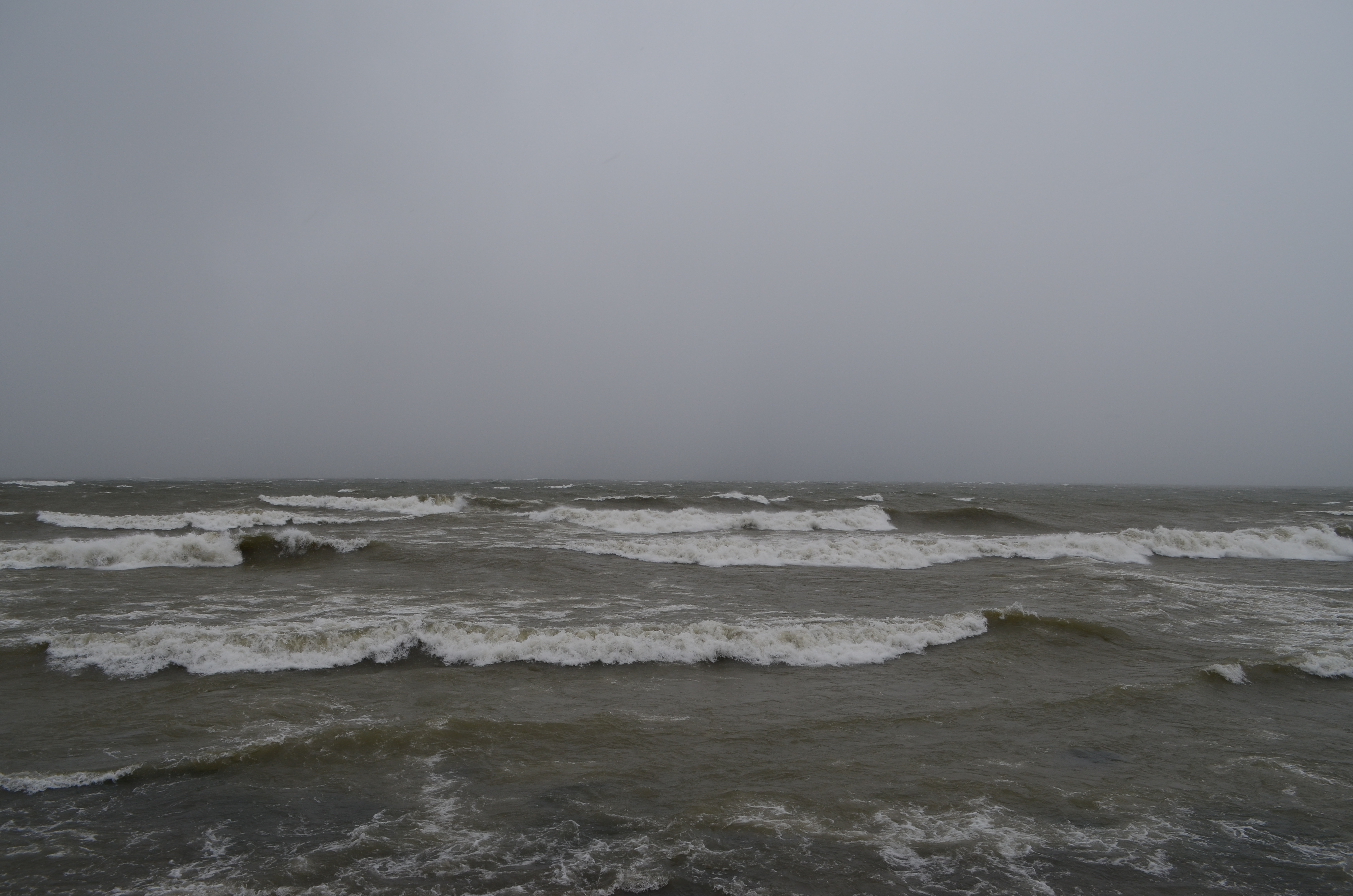
Snow dunes at the Lake Ontario shoreline behind Waterbury Hall on Sunday, March 19. This are the result of 3 straight days of cold wind, driving freezing waves into the shore. Do not walk on them – they are often not stable and you risk falling through into icy cold water!

DSC_1845

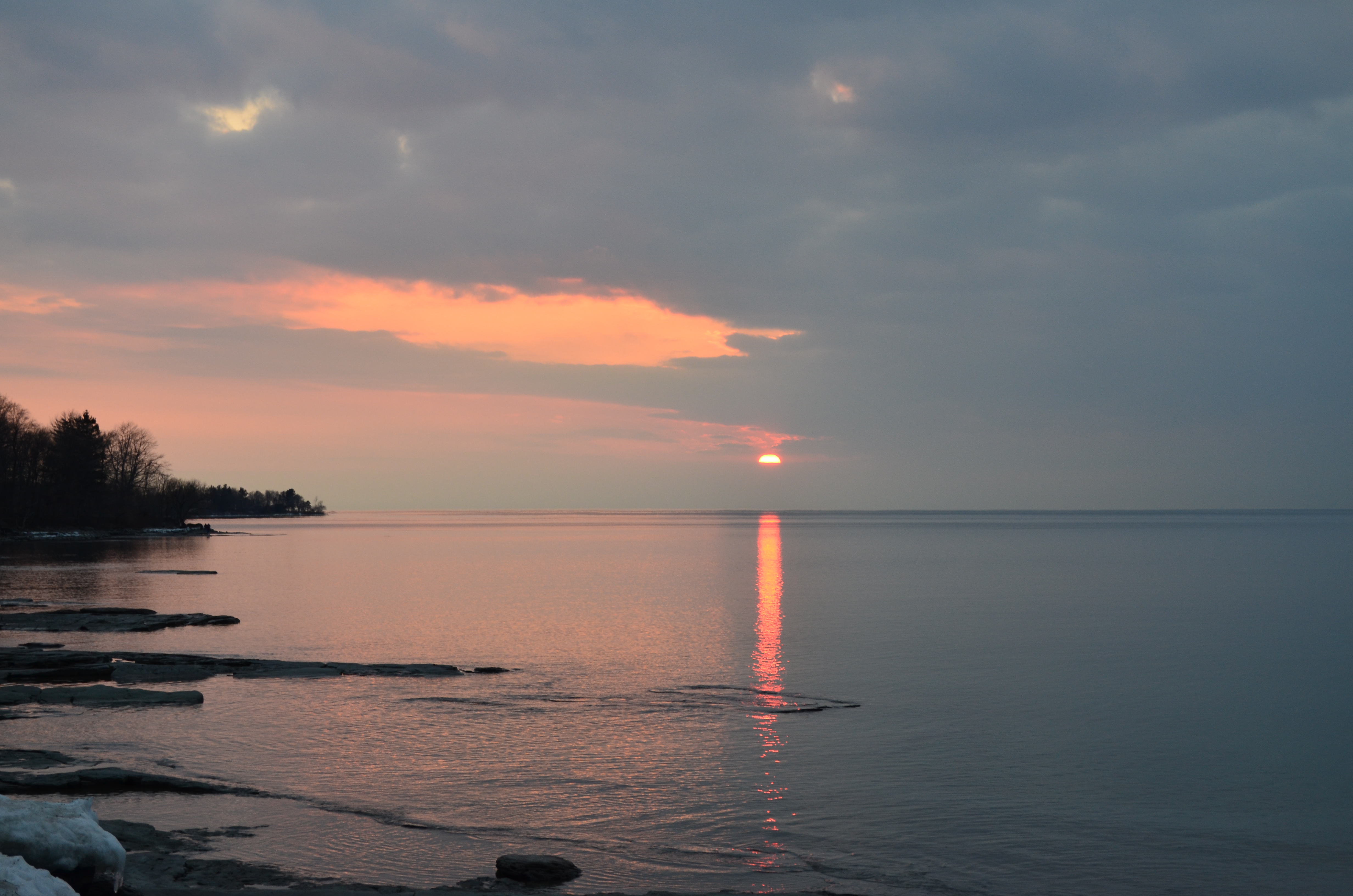
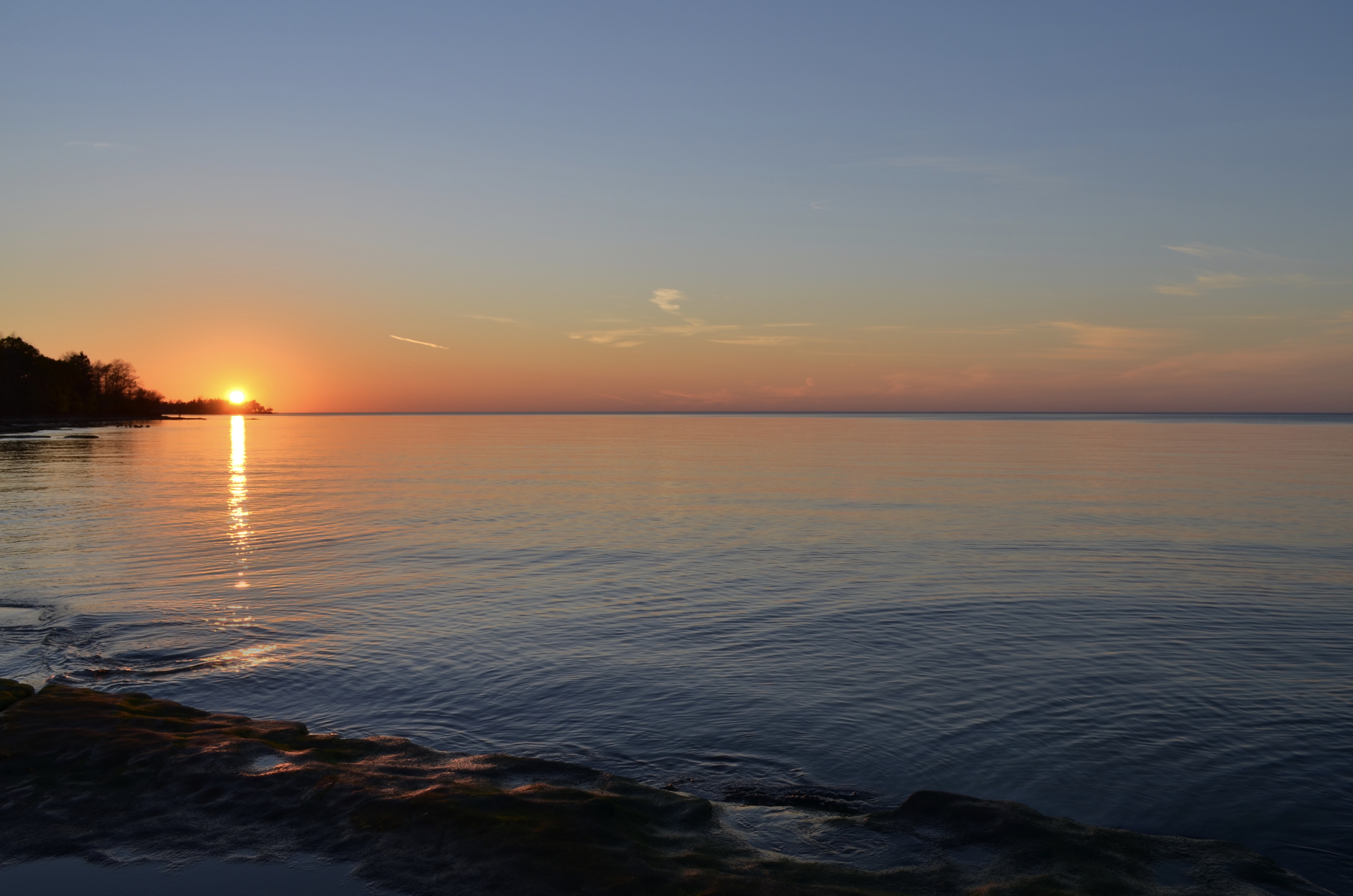
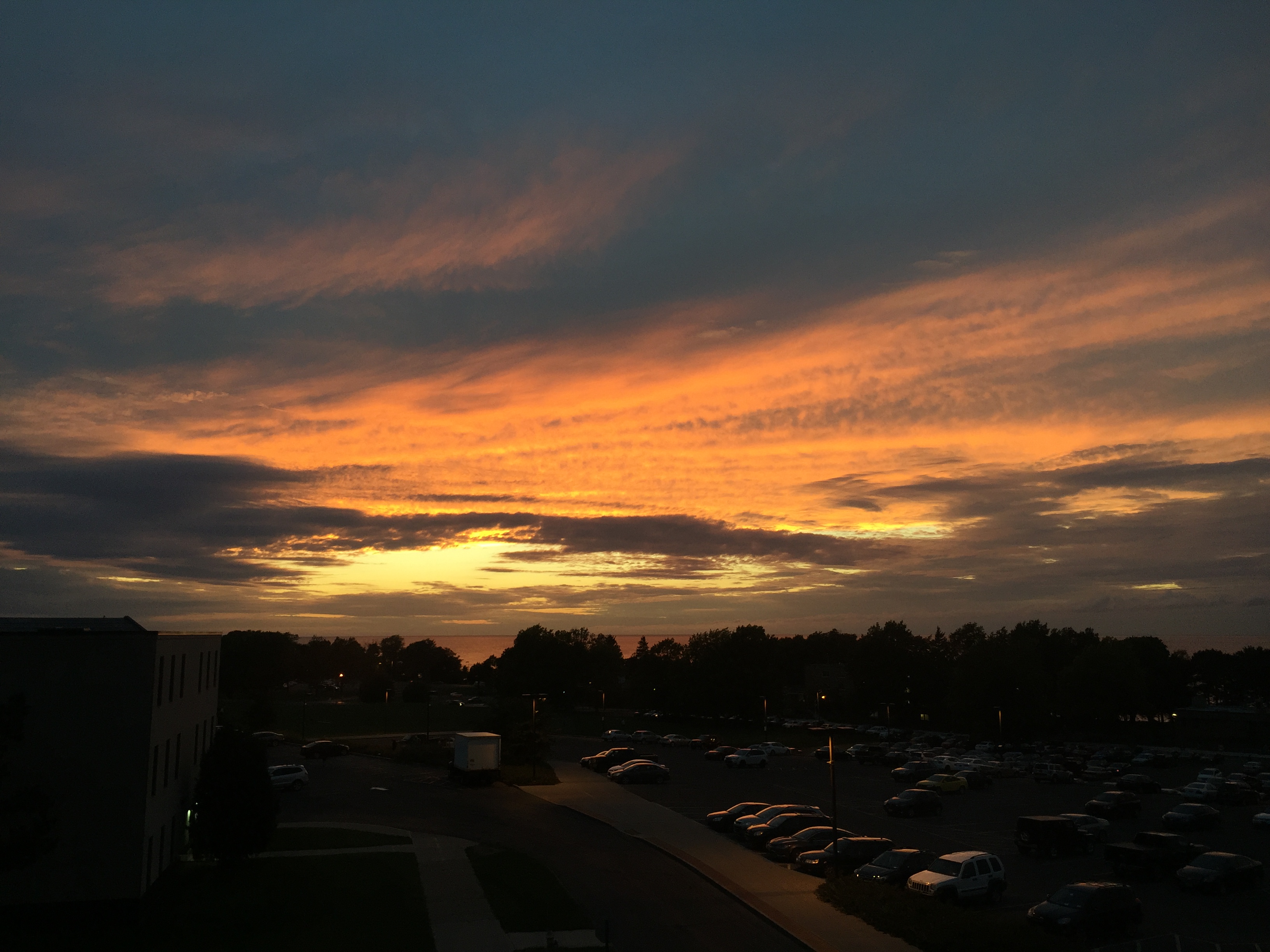
Sunset on Sunday, March 19.
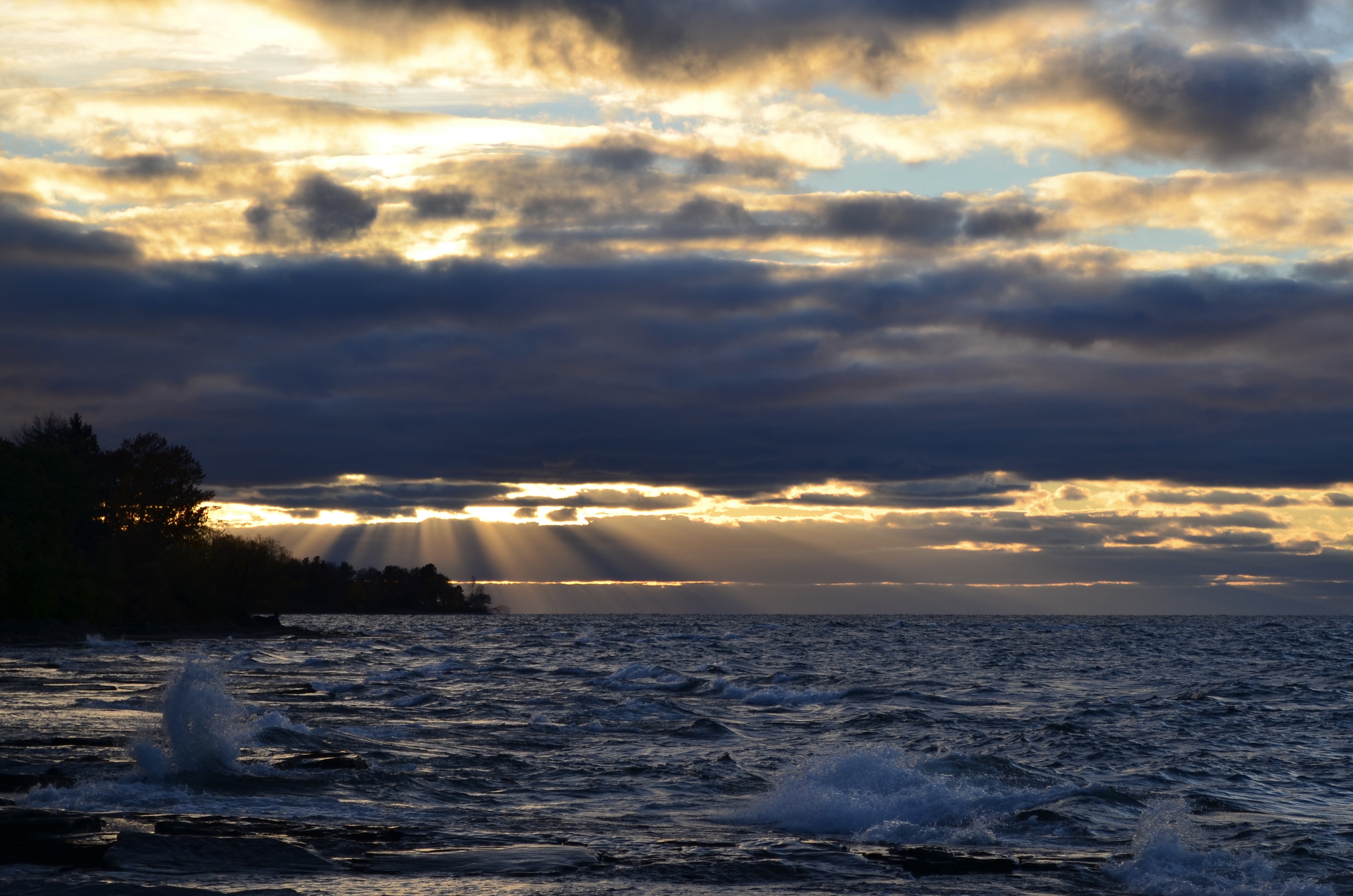
Summer in February

Hello, Oswego!

You’ve now survived 5 weeks of classes, and spring break is less than 2 weeks away!

Mother Nature appears to have taken her own sort of spring break this week. Normally, we’d still be in the 30s at this time of year with the threat of snow storms. However, temperatures have soared above 60º on several days, putting spring fever into full effect. Crazy!

As a matter of fact, many locations in the Northeast and Midwest U.S. have set new *all-time* February record high temperatures. A large-scale pattern shift prompted the warm temperatures. High pressure, which brings fair weather, took hold over the eastern US last weekend. The high acted to pull warm air from the South northward, and coupled with the usual heating a location receives from the Sun, produced anomalously warm temperatures as a result. Further, a storm system late this week helped draw even warmer air northward. Syracuse, NY set its all-time February high of 71º on Friday. That kind of warmth is normal for late-May!

DSC_1695

The sunset on Wednesday, Feb. 22.

DSC_1743

Thunderstorm shelf cloud as seen from Shineman on Saturday, Feb. 25. This storm was along the front that put an end to the Spring-like warmth of late. (Sad face.)

Here in Oswego, a number of interesting factors came into play while the warm spell was ongoing. Most notably, on Friday, while Syracuse and other parts of CNY basked in 70-degree warmth, Oswego remained in the 40s much of the day. This was due to a stationary front, or a separation of warm and cool air masses that (relatively speaking) does not move, that set up shop just to the south of Oswego. Later that evening, when this front lifted northward, campus warmed from 38º to 65º in about one hour!

This upcoming week looks like a roller coaster of temperatures. Midweek looks mild, while next weekend looks wintry. Hang on tight, folks, spring is just around the corner!

7IIh5y2

“Spring is just around the corner.” Ha ha.

Thundersnow!

Hello once again, Oswego!

This past Thursday night (Dec. 8), campus experienced one of the world’s wildest wonders of nature: Thundersnow.

screen-shot-2016-12-10-at-11-01-07-am

Screen capture from a video I had rolling during the thundersnow, around 11:15 Thursday night. It almost looks like daytime!

It is exactly as it sounds: Lightning and thunder that occurs while it is snowing outside. While rare for any part of the globe, it is about a once or twice-a-year occurrence here in Oswego.

The process that goes into creating thundersnow is very similar to that of an ordinary thunderstorm. In a nutshell, a charge separation builds up between the clouds and the ground, and a discharge in the form of lightning ensues. However, it is much harder to create this charge separation during the colder months.

Here in Oswego (or anywhere near a Great Lake, for that matter), we have a secret weapon: Lake Ontario. During lake effect snow, combinations of conditions can come together to create such a charge separation. For this event, there were three main factors. The first was the “background” ongoing lake effect snow event, which had dropped well over a foot of snow on the Tug Hill. Lake effect circulations provides lift to the atmosphere, creating tall, thick clouds capable of producing precipitation (in this case, snow). Second, an incoming cold front provided a boost to this lift. Third, small circulations known as mesovortices developed within the lake effect snow band. This created “cells” with appearance on radar similar to a summertime pop-up thunderstorm. All of these factors combined to generate enough of a charge separation for lightning in the Oswego area.

Other areas away from the Great Lakes experience thundersnow as well, however conditions aren’t usually favorable in other systems (think nor’easters) as often as they are in lake effect.

So, now you know why Jim Cantore goes wild every time he experiences thundersnow. In the upcoming week, several chances for snow exist, namely Sunday night and Thursday-ish. Keep an eye to the sky late week if you’re traveling home.

I’ll resume posts at the end of January. Have a great winter break!

Snow Day!

Hello Oswego! I hope you all had a wonderful Thanksgiving break.

In the week before break, we only had one day of classes because of a snow day on Monday (Nov. 21). Why did this happen, do you ask?

Firstly, and obviously, the snow. It snowed, and snowed, and snowed, nearly constantly from Sunday afternoon into Tuesday morning. The lake effect machine just would not quit! The city of Oswego picked up about a foot and a half from this storm. Other areas of upstate NY picked up 20-30″, indeed making it a historic lake-effect event for the region. Campus, however, only received a couple inches, because it all blew away!

The wind was the other major component of this storm. While the snow did not necessarily pile up, the strong winds blew it all around, and likely this was the main driving factor in the decision to cancel classes. Wind speeds generally ranged in the 30-45 mph range from Sunday to Tuesday, with a top gust of 70 mph recorded Monday evening at the Oswego buoy!

dsc_0913

Angry lake on Monday, Nov. 21.

Since then, all of the snow we received melted fairly rapidly, and it has generally been mild with occasional light rain events. No major weather is in the offing in the next week. Happy almost-finals, Oswego!

Winter is Coming

Hello, Oswego! Who’s ready for some snow? I think I am. I’m writing this blog while it is 62º outside, with a lake effect snow warning in effect for tomorrow and Monday. Oh, Upstate New York.

What goes into an Oswego winter, do you ask? Many things, that is. Being right on the shore of Lake Ontario, lake-effect is a huge factor in Oswego winter weather. Nor’easters, as well as other storm systems, also contribute to the piles of snow around here (those familiar with the blizzards of 1966, 1993, and 2016 will know all too well).

Our main driver of snow in Oswego involves Lake Ontario, in the form of lake-effect snow. In late fall and winter, cold air masses passing over the relatively warm waters of the lake aid in developing clouds, and eventually, snow. Lots of snow. Several other conditions must be met, however, to achieve maximum snow potential. Generally, to get heavy snow here in Oswego, we want the wind to be coming from the west. This would mean the wind would travel down the long axis of Lake Ontario, maximizing the amount of moisture added into the air. These winds must not be too strong nor too weak (15-30 mph is a good range), and also remain relatively constant in direction, or else a given area will not experience snow for a sustained period of time. Additionally, the air must not be too dry, or else all the moisture that would go into producing snow, will just evaporate.

In a typical season, Oswego will receive around 140″ of snowfall. Roughly 1/2 of this is lake-effect related. Last winter, this number was much lower due to persistent very mild conditions. I’m no expert on long-range forecasting, but I have a feeling we’ll see more snow this winter than last. Stay tuned!

P.s. Here’s some pictures of the lake at sunset last night. Don’t expect it to look like this come Monday.

fullsizeoutput_31d

dsc_0901

The End of Autumn is Near!

Hello again, Oswego!

Last weekend, daylight saving time ended, leaving us with an extra hour of sleep. Hope you all enjoyed it, and I hope it did not mess up your internal clock! For me, it means getting new weather model data an hour earlier. #MetMajorThings

The past week-and-a-half has not featured much active weather here in Oswego. There has been a decent uptick in the wind this week, which generally has blown down all the beautiful fall foliage that was found across campus just this time last week. I managed to grab some pictures over last weekend of the fleeting tree color:

dsc_0819

fullsizeoutput_2fa

These trees are now bare, thanks to the strong winds of the past few days. Just this morning, we had several gusts of 50 mph recorded either on campus or at the Oswego buoy station, located near the Lighthouse.

We have also experienced an unusual abundance of sunshine relative to November standards this week. Normally, for about 4/5 of all days in the month, Oswego would experience mostly cloudy to cloudy conditions. This week has featured only 1 such day.

fullsizeoutput_30c

Lake Ontario at sunset, Nov. 9

fullsizeoutput_30d

Sun rays (scientifically: crepuscular rays) bursting through the clouds, Nov. 9

As we head deeper into November, the temperature will continue to decrease. Whether you’re ready or not, snow in Oswego will be a thing once again over the coming months. It may be delayed a bit this year, however, as the overall weather pattern in the Northeast U.S. looks to trend warmer than average for the second half of the month.

My next post will focus on the (sometimes dreaded, sometimes beloved) Oswego snow, and what goes int0 the making of an Oswego snowstorm. Have a great weekend!

The Perfect Oswego Sunset

Whether it’s hot, cold, windy, or even sometimes cloudy, the Oswego sunset is always a fascinating sight to see. As a SUNY Oswego student for a little over a year, I have witnessed hundreds of sunsets so far. Being a meteorology major, sunsets come as second nature to me. I’ve had countless memorable sunset runs, many of which I had my camera in tow.

fullsizeoutput_9b

I’ll start with the basics – shown here is the sunset from Sept. 20, 2015, taken from the lakeshore behind West Campus. Calm waters, still-warm temperatures, and a crystal clear sky made for a relaxing evening. When the lake’s very calm, the sun can take on an appearance that it is “melting.” Photo credit: Matthew Seymour


dsc_8514

Dec. 6, 2015 – the Sunday of finals week during the fall 2015 semester. The temperature was unusually warm for the time of year, and the sky was fairly cloudy. All of a sudden, the clouds exploded into color like a fireball. Students came rushing down to the lake to capture the beauty of the pink post-sunset sky. Several of these type of sunsets occur each year, but this one was particularly notable for its intensity and duration of strong coloration. Photo credit: Matthew Seymour


dsc_8936

March 16, 2016. The day before St. Patrick’s Day. A bright rainbow, or should I say THREE rainbows, appeared in the sky opposite the sun. It’s a sight I had never before seen. The third rainbow (the fainter one in the middle), known as a “reflection rainbow,” is formed when sunlight bounces off the (calm) lake water first, then refracts through the falling raindrops. [P.S. I assure you there was a sunset here, despite the actual sun not being in the photo.] Photo credit: Matthew Seymour

dsc_0507

Finally, one of my most recent sunset photographs, from Oct. 6, 2016. Photo credit: Matthew Seymour

As you can see, no 2 sunsets are alike!

So, you’ve seen and heard about the sunset. You ask now, where on campus can I see this for myself?

Based on my experiences, anywhere where you can see the lake as far out as possible is a great sunset-watching spot. This includes, but is not limited to:

  • Anywhere along the lakeshore. Now, if you prefer flat stones (with a few large boulders sprinkled in) as your shoreline choice of rock, head to East Campus behind the lakeside dorms. Round cobblestones, head to West Campus. (Either way, it rocks!)
  • The 3rd and 4th floors of Shineman Center have great vantage points.
  • If you’re lucky enough to live in the upper floors of a high-rise dorm, these spots offer more-than-adequate views of the famous sunset.
  • Off-campus: Areas such as Breitbeck Park, Rudy’s, and the Oswego Bluffs are excellent choices.

That does it for me today. Happy sunset chasing!!!

When thunder roars…

…Go indoors! (But really, that’s how the saying goes. Practice your lightning safety, folks.)

Hello everyone, and Happy October! What has the wonderful weather of Oswego been up to lately, you ask?

Well, the month has come in with a literal bang, as campus experienced a rather noisy late-season thunderstorm on Oct. 2.

dsc_0434

Photo credit: Matthew Seymour

Around 5:15pm on Oct. 2, this massive-looking cloud formation, known as a shelf cloud, appeared in the western sky. This cloud is commonly found at the leading edge of thunderstorms, and can signify incoming strong winds. Sure enough, about 5 minutes later, the wind became gusty and rain began to come down in buckets. So, if you see a shelf cloud, better run for cover!

image1

Photo credit: Matthew Seymour

Today, Oct. 3, started out cloudy in the morning, with the sun shining by the time afternoon rolled around. But, something else was in the air – I almost mist it. (Ha ha) A thin layer of fog rolled in off the lake during the early afternoon. This fog likely formed due to a relatively humid air mass moving over the cooling lake waters. But more striking is the appearance of a faint white arc, known as a fogbow. Fogbows are formed in a similar process as rainbows, however in this case, the sun’s rays refract off of fog droplets instead of raindrops.

img_6851

Photo credit: Matthew Seymour

Additionally, the sunsets continue to impress. Shown is the sunset from Sept. 29, as I viewed from the second floor of Shineman Center.

Be on the lookout for my next post, which will tell you about some of my sunset experiences, and where to go to get the best views and best photographs alike. Until next time, folks!!

Rice Creek!

kakaotalk_20160926_143320401

Hi!!! I am Ye Jin Lee from Cheong ju, Korea. I am majoring in Public Relations.

I am a new transfer student in Oswego also i am a new student blogger!!! When i first came in Oswego, i fell in love with the lake and also Lakers. Oswego is a place which i really want to recommend not only American but also Korean. I realized there are many Korean students and also there are many American students who are interested in Korea.  If you have any questions about my country or my posts, you are more than welcome to email me:)

Sep,25th!

Ikakaotalk_20160926_143322862 went to the Rice Creek with Taegundo club members. I didn’t know there is a hill near campus but thanks to my friends i got a chance to walk the hill.


It waskakaotalk_20160926_143340861 a nice weather(it was not cold at all ) to walk under the sun. i follow the Orange line first and then continued with the Green line. I want to explain how to go there in detail. But unfortunately, I am a person who is bad at remembering the way to go somewhere. I just followed my friends and came back. I saw the sign which says Rice creek at the main entrance of campus.(hopefully, i can be a hint)


Can you see the sky in my pictures? It was a perfect blue sky. That is why we jumped on the grass like we are flying.


kakaotalk_20160926_143329048kakaotalk_20160926_143336890kakaotalk_20160926_143331002kakaotalk_20160926_143333029


I took 3 hours total by walk. It is a nice way to work out and get some fresh air. Come out from your dorm and be healthy!! It is secret but i folded up for 1 hour after i arrived my dorm.  I highly recommend to everyone to go there and enjoy the sun before winter come!!

Welcome to Autumn!

Hello everybody! It’s that time of year again…

Autumn!!! Or fall. Or pumpkin spice everything season. Whatever you prefer to call the three months between Sept. 22 and Dec. 21.

Here in Oswego, that means a few things. Swimming season at the lake is coming to an end. Temperatures begin to drop, and windy days become more numerous by the week. The green trees will soon become adorn in red and orange fall colors. And before you know it, well I won’t mention the dreaded s-word just yet…

So far this season, we haven’t really experienced true “autumn” weather in Oswego. A warm pattern, a continuation of the hot and dry summer Upstate NY experienced this year, carried over into September. Here in Oswego, the daily high temperature reached above 70ºF everyday this month through Sept. 23, even on a few occasions eclipsing 80º. Doesn’t sound like autumnal weather to me!

Meanwhile, the low temperature has dropped below 55º only four times so far this month, and did not reach the 40s until the morning of Sept. 25.

A tranquil sunset on Sept. 21 at the campus lakeshore. [Photo credit: Matthew Seymour]

A tranquil sunset on Sept. 21 at the campus lakeshore. [Photo credit: Matthew Seymour]

Keep in mind that, on average, high temps drop from the mid 70s on Sept. 1, to the mid 60s on Sept. 30. Lows normally go from the upper 50s on Sept. 1, to the upper 40s by month’s end.

Just this past Friday, a strong cold front finally pushed through the region, putting an end to Oswego’s extended summer weather. Temps the past couple days have been right around where they usually are, if not a little below normal. What a relief!!

A large wave crashes into the lakeshore the evening of Sept. 23, during strong northerly winds that followed the passage of a cold front in the morning. [Photo credit: Matthew Seymour]

A large wave crashes into the lakeshore the evening of Sept. 23, during strong northerly winds that followed the passage of a cold front in the morning. [Photo credit: Matthew Seymour]

The autumn-like weather looks to stick around this time, with cool temps continuing for the next several days. Have a great week!!