Hello, Oswego!
If you’ve been outside, or at least looked outside your window recently, things have changed colors a little. Snow has finally descended upon the region!
A number of minor to moderate snowfalls have occurred in Oswego the past couple of weeks. While the first official accumulating snow was way back on November 13th, the first snow that actually stuck around just occurred last week. A little over a foot has fallen since, though not more than a few inches at once.

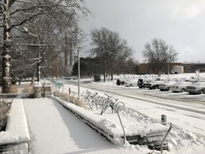
The blanket of white left behind after a lake effect snow band dropped 3″ of the white stuff on campus the morning of Sunday, December 10.
Now, why haven’t we had a large snowstorm yet this season in Oswego? We are in lake effect country, after all!
Much of it has to do with the wind direction. If the wind shifts too quickly, the lake effect snow will pass right over us, only impacting campus for an hour or two, enough to drop a quick 2-3″ but no more. If a lake effect event were to drop a lot of snow, the wind needs to be steadily blowing in the correct direction (west-northwest, ideally) for several hours or more. Thus far this year, that has not occurred.
And, for a reason not well known, that wind direction does not happen very often. Maybe it’s because there are meteorology majors like me here, and it’s scared of us…

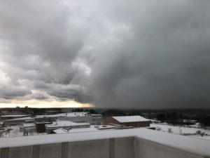
A lake effect snow band hangs just offshore as viewed from Shineman Center on Tuesday, December 12.

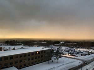
Neat: The setting sun shone its rays on the same lake effect band pictured above, creating an eerie yellow glow to the falling snow.
There’s plenty more winter to go, though. Storms of the lake-effect and not-lake-effect variety will impact campus periodically, as the weather pattern is shaping up to befavorable for cold, wintry weather the next several weeks.
Happy Holidays and enjoy your winter break!


